Waxing Gibbous Moon
The ever-evolving Bay Area Ridge Trail will eventually be about 550 miles long, encircling the San Francisco Bay region with access for hikers, bicyclists, and equestrians. Currently, something like 325 miles are in play and plans call for much more to be completed in the near future. The closest it will come to where I live is Gilroy, in Santa Clara County, about 15 miles away.
I have walked or ridden small parts of the South Bay area trails without thinking of the bigger picture, but this week's hike on the Coyote Ridge Trail in Coyote Lake Harvey Bear Ranch County Park near Morgan Hill, CA sort of got my juices flowing. The positives are obvious - getting out and beating my feet in the coolest remaining places closest to home - but the negatives are considerable. Gasoline is expensive and obnoxious and traffic is brutal getting to any of the trailheads. For the most part, there is no backpacking/camping allowed, so extended, long hikes are problematic or impossible without complicated vehicle shuttles and even more complicated arrangements with hiking partners. Proximity to gargantuan population centers is a big turnoff. But it's THERE. And it's CLOSE. So it's TEMPTING!
This week might have been the prime time for hiking the Coyote Ridge Trail. There were hardly any other hikers and there was so much GREEN sprouting up everywhere. This ridge is blue oak heaven and the views down to Coyote Lake were really nice. The lake level is very low, like most reservoirs in the state right now, but it's still a pretty sight.
 |
| Looking down to the lake from Coyote Ridge. |
 |
| Bird's eye view of the lake. See the hawk? |
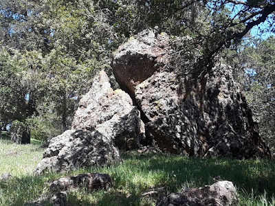
The trees were the star attractions on this hike for me. I saw a few deer and cows and lots of hawks and ravens, but the wildflowers were pretty scarce, so I spent most of my time admiring the the oaks and the rocks of the Franciscan Formation. The Calaveras Fault runs right through the park, too.


No comments:
Post a Comment
Note: Only a member of this blog may post a comment.