Tuesday, February 22, 2022

Alum Rock Park/Sierra Vista Open Space Preserve, San Jose, California

 Waning Gibbous Moon

Yesterday was Presidents Day in the grand ole USA, even on the east side of San Jose up in the Diablo Range. I expected to share my hike with lots of people on a holiday and I was right. Alum Rock Park, very beautiful and well-kept, was crowded, but pretty peaceful. Once I started the steep climb away from Penitencia Creek in the heart of the park, there were far fewer people and the sounds of conversations and engines gradually disappeared. The only noises were my own deep breathing, the click of my hiking poles, and the crunch of my shoes in the dirt. I was soon way above the fray and enjoying every minute.

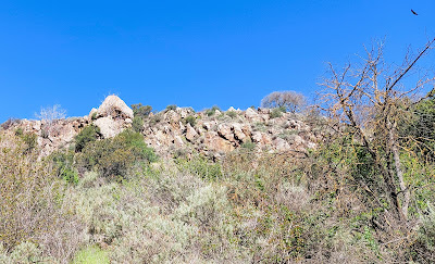
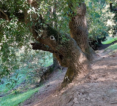
Looking up at Eagle Rock. No, that's not an eagle - it's a turkey vulture.

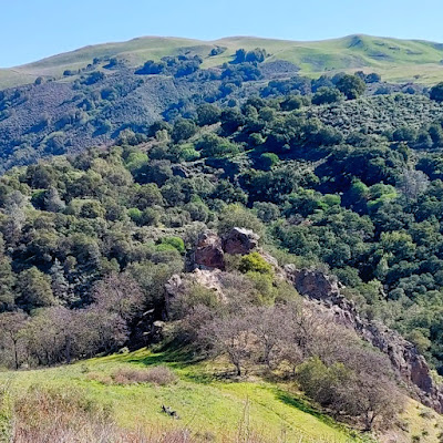
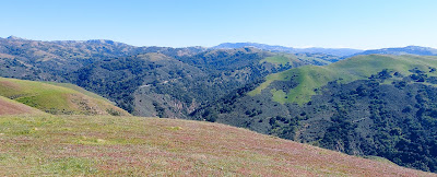
Looking down at Alum Rock

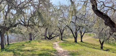
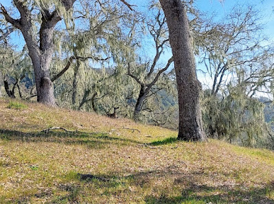
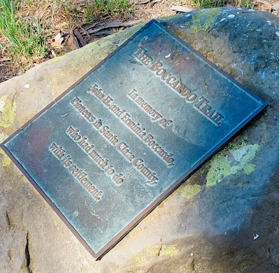
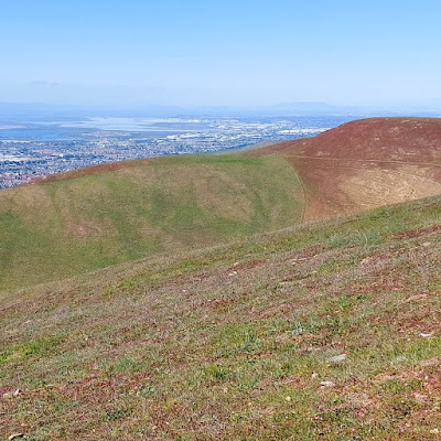
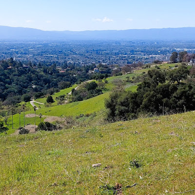
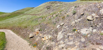
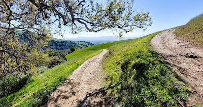
The North Rim Trail lead me to the Todd Quick Trail, where the grade increased dramatically. The "trails" on this hike are hard-packed fire roads climbing up grass-covered hills that overlook San Jose and the surrounding mountains. The cool northwest winds kept me moving at a good pace and I was happy to notice a significant increase in leg strength compared to a few weeks ago. When I reached the intersection with the Boccardo Loop Trail, the border with the Sierra Vista Open Space Preserve, I opted to go clockwise, passing through fields just beginning to show a few poppies, with occasional wooded areas that blocked the wind. A steady 1.1 mile climb with terrific long views brought me to the 0.5 mile side trail up to an unnamed 1,896 foot peak with a bench and 360 degree overlooks. 


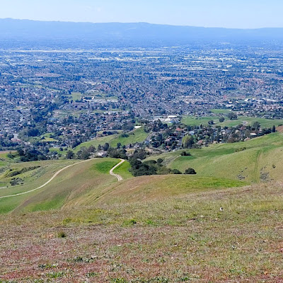
I only spent a few minutes on top. The wind was chilly and a smoochy young couple was occupying the bench. I snapped a few pictures of the views (none of the couple) and left them alone to resume smooching. Aww, they were so cute, hahaha.


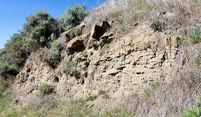
I was happy about my clockwise choice when it came time to descend. That part of the Boccardo Loop was longer, but it switchbacked down to the Todd Quick Trail, making it much easier on my rickety old knees. This turned out to be my favorite part of the 6-mile hike, probably because I wasn't breathing or sweating as hard as I had been going straight uphill. The switchbacks also exposed more rocks, which added to the interest factor, making the route seem more like a normal trail.


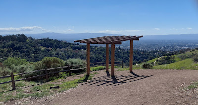
There are a couple of shaded rest stops with benches on the way down and one sort of work-in-progress ramada with a nice view. I stopped there to chug some water and eat an energy bar before heading back to the parking lot. Most of this hike is part of the Bay Area Ridge Trail. There is another section in the Sierra Vista Open Space Preserve that is also part of BART, so I will return to do that some day soon. I'll pick a less crowded weekday to do that one.


Peace, Love, and Holidays,
Jim

#2,022 in 2022

Thursday, February 17, 2022

Henry Coe State Park - Frog Lake

 Waning Gibbous Moon

Henry W. Coe State Park covers about 87,000 acres, making it the biggest state park in northern California. In 1953, Sada Coe Robinson, daughter of Henry and Rhoda Coe, donated the Pine Ranch property to the state to form the core of the park. It is still largely undeveloped, but access to the trails is pretty well maintained. Opportunities for hikers, backpackers, equestrians, and bicyclists to explore trails and old ranch roads are many. Most of these pathways are very challenging, leading up and down the many ridges and hills that dominate the mostly dry, very peaceful landscape. 

"May these quiet hills bring peace to the souls of those who are seeking." Sada Coe Robinson

I have found this park and its trails to be an ideal training ground for hikes in the Sierra Nevada and Cascade Range. It takes several trips to bring me up to speed, though. Yesterday's little adventure was my third one in Henry Coe this year, meaning I am still in the beginning stages of getting in mountain shape. My goal was a 6-mile hike in the general direction of Mt. Sizer, where I hope to overnight sometime this Spring. After a quick, awkward chat with the friendly ranger at park headquarters (he, too, is deaf in his left ear), I decided on an out and back hike to Frog Lake from headquarters, using the Corral Trail, the Flat Frog Trail, and the Frog Lake Trail. It was not the shortest or most direct route to the lake, but it turned out to be an outstanding experience. The weather was perfect and the trail was not at all Henry-Coe brutal. It was relatively flat, in fact, a fast single track with a lot of shady oaks and madrones. I only saw two other people and no bikes. I was able to stretch my legs and motor at a pretty good clip, stopping only to take pictures and soak in the scenery.


Frog Lake was a most pleasant surprise. Most of the lakes and ponds that I have visited in the park have been pretty awful - stagnant cow and pig wallows. This one was quite beautiful, a perfect place to sit and munch and watch the cool breeze alter the reflections on the lake's surface. It was kind of intoxicating, really. None of my Smartyphone photos truly do my Frog Lake lunch stop justice, except maybe the last one.


The way back was just as fun as the first half. I was pleasantly tired without feeling beat up, so chalk up Wednesday as another good day on the trail. The rest of the way to Mt. Sizer will be much harder, but this route will be part of my approach no matter what. 

I was drawn to this unusual outcrop just off the Flat Frog Trail - echoes of ancient ceremonies?

Peace, Love, and Thank You, Sada,

Jim

#2,022 in 2022

Tuesday, February 15, 2022

Henry Coe State Park - Lyman Willson Trail

 Full Moon

I never met Henry Willard Coe or Rhoda or Sada Coe, or Horace or Lyman Willson for that matter, but judging by the places now named after them, those sonsaguns and daughtersaguns and the Mutsun Ohlone indigenous people before them must have been pretty tough cookies. If you go for a hike on any of the trails leading to the ridges in Henry Coe State Park, you are in for a workout. With an average grade of 12% and a maximum grade of 28%, the Lyman Willson Trail from Hunting Hollow to Steer Ridge is what one goldurn internet whippersnapper called "a healthy climb." Okay, we'll go with that. 

Yesterday, I went for a healthy day hike on the Lyman Willson Trail with the idea of maybe doing an overnighter up to Vasquez Peak next month. This was a shakedown cruise of sorts. I had hiked up to Willson Camp and Willson Peak many years ago, but many years ago doesn't really count any more. I needed to determine if I can still romp with the ghosts of the past on their paths into the backcountry. I did not exactly do any romping, but I managed a respectable six miles of walking with a peanut butter and banana sammie picnic at the turnaround point, so I am counting that as a win. I didn't see any other sonsaguns or daughtersaguns up there, so I must have been doing something right. 

After four or five easy creek crossings down in Hunting Hollow, I hung a left on Lyman Willson Trail and immediately began to climb up into lacy lichen covered oak forests interspersed with steep wagon trail grass fields. Wildflowers were just beginning to show their faces and I was treated to a sighting of two does and a magnificent, wary, 8-point buck. The does were curious and let me take a couple of pictures (Valentine's Day flirts?), but the buck wasn't having any of that, disappearing into the trees as soon as I reached for my Smartyphone.


The Bowl Trail cuts over to Willson Camp, where there is a year-around spring, a California State Park potty, and a few old structures leftover from the cattle ranch days. From there, it's a relatively easy hike to Vasquez Peak, so I am confident that I can do that as an overnighter. I need to wait for warmer nighttime temperatures so I can go light on gear and enjoy the hike. This Palomino is not a beast of burden, nor am I a speed merchant. At this stage, I just like to cruise along and look up once in a while.


Peace, Love, and Dates with Does,
Jim

#2,022 in 2022

Friday, February 11, 2022

Forest of Nisene Marks State Park, Aptos, California

 Waxing Gibbous Moon

With a little stubborn effort and a lot of sweat, I managed to turn an 8-mile hike into a 10-mile hike yesterday. There was no magic wand involved, just a dumb jog to the right when I should have adroitly switchbacked to the left. This error led me to a steep mountain bike trail straight up to a ridge where I realized, un-adroitly, that Bridge Creek would not be flowing on top of a ridge and, duh, I was no longer on the Bridge Creek Trail. That realization was important because the Bridge Creek Trail was the way to Maple Falls, which was my semi-planned turnaround spot for the day. I didn't know if there would be any water in the falls this time of year, but finding out was a point of interest. My hike now had two turnaround spots and two extra miles. In the grand scheme of things, this was not a big deal, but still...

The weather was perfect and the redwoods and tan oaks were beautiful and there were hikers and joggers and mountain bikers aplenty when I left on foot from George's Picnic Area on Aptos Creek Road. That led me to Loma Prieta Grade Trail (a mile or so from the 1989 Loma Prieta earthquake epicenter) and eventually to the Bridge Creek Trail toward Maple Falls. My first choice had been Five Fingers Falls, but I learned that the trail to that one was closed. The Ranger at the park entrance said there were no plans to re-open it any time soon. I didn't mention to him that there are a dozen or more accounts of people hiking that closed trail available for downloading right that second on the internet. I didn't want to interfere with his illusion that the park was not full of happy-go-lucky people who didn't give a rodent's bee-hind about his closure info. 

But, ever the copasetic rule follower, I went with Plan B to Maple Falls. And the road to the trails was great. 


I even got to see a couple of banana slugs, always a fun experience at Nisene Marks.


After the aforementioned detour, the trail followed the creek into a steepening canyon. The trail crossed back and forth across Bridge Creek on two, you guessed it, bridges. I passed the Bridge Creek Historical Area, which was mostly a jumble of king-sized Lincoln logs. 


As I got closer to the falls, there was a little bit of rock climbing involved, but nothing too difficult. Eventually, I came to a place that I thought might be Maple Falls. There wasn't much falling water and the way up the canyon seemed blocked by fallen trees. When I got home, I found out that the real falls is much bigger and a little further up the creek. Now I know for next time to climb over the rubble. It's all good, I had fun anyway.


The good news is that I was able to complete a moderate 10-mile hike with only a little soreness in my knee and some general fatigue. That tells me I have made some progress in my conditioning. Usually (if there is such a thing as usually for me anymore), when I can do 15 miles, I am ready to go backpacking. I am hoping to get there in the next month or so, then head somewhere special.

Peace, Love, and Progress,
Jim

#2,022 in 2022

Tuesday, February 8, 2022

Pinnacles National Park - Old Pinnacles Trail to Balconies Cave

 Waxing Gibbous Moon

We should probably stop using the word "unseasonably." Who knows what the weather will bring and how it fits with what the calendar says or what we are used to? Does that even make any sense to someone who was born in this century? I don't know. 

One thing for sure is that to me, it was pretty hot yesterday in Pinnacles National Park for the first week in February. I didn't mind at all, in fact I welcomed the warmth, but I was seriously over-dressed and shed a couple of layers in the first mile of my hike. I didn't get all riled up about it. It was what it was, just like the 20th century, when February was winter time, was what IT was.

I needed a break from rassling with traffic on Highway 101 to reach another Bay Area Ridge Trail destination, so yesterday I took a country drive 38 miles from my camp to Pinnacles National Park. My intention was to hike part of the North Wilderness Trail from the Old Pinnacles trailhead, but for some reason, where the route splits in two directions, my feet turned up toward the Balconies Trail instead. It's all good, winter, spring, summer, or fall.

Much of the trail was shaded along the West Fork of Chalone Creek.

Very unusual erosional remnant, reminiscent of a lava tube.

The underside of the eroded half tube-shaped feature.

A pinnacle!

Layers of volcanic tuff hardened, tilted, and eroded over time.

Balconies Cave is accessible from both the west entrance to the park near Soledad and the east entrance south of Hollister. A flashlight is required after you go inside unless you are one of the oddball cat slash bat people among us who can see or perceive echo signals in the darkness. I would recommend a hardhat, knee pads, and gloves as well because you may bang your head, slip, and skid on your hands and knees with regularity in this cave. I didn't bring any of those things with me on this hike, mainly because I have been there and done that and I am too old for that sh*t. I was quite content to clamber over the rocks which led to the entrance and inspect those things which were visible in daylight.


The caves at Pinnacles are talus caves, not limestone caves. So if you decide to go inside with your eager and nimble children, you will explore the spaces between huge jumbles of fallen rocks, not dissolved caverns with stalactites and stalagmites. Some of the spaces are quite small, some are bigger, parts of the way through the jumbles are straight and level, but most are not. What these two types of caves have in common is consistently pitch black darkness. That said, all kinds of dorks and dweebs make their way with their offspring through Balconies Cave every year and you can, too. 

I was fortunate enough to look up just as I reached the entrance and what did I see but a California condor soaring in the air space directly above me. It made a few circles before it perched on a tall pinnacle, rested a few beats, and took off. The whole thing lasted less than twenty seconds as I was also perched on some rounded, exposed boulders that required three points of contact to avoid nasty road rash and an uncomfortable airlift experience. Hence the lack of photographic evidence. However, I managed to scramble back down to level terra firma and watch while a few more condors joined in the magical soaring circus. They were wayyyy up there and my Smartyphone camera doesn't really do the telephoto thing. But if you look closely at the sky in this picture, that dark speck above and to the left of the tallest dark pinnacle is a giant bird whose ancestors almost went extinct at the hands of a careless, anonymous, invasive species. Go see one. It will make you feel hopeful.

Fly high and stay free.

Peace, Love, and Long Live the Condor,
Jim
#2,022 in 2022