Saturday, February 5, 2022

Joseph D. Grant Park, Santa Clara County and Mt. Hamilton Lick Observatory

 Waxing Crescent Moon

I started the day yesterday with an excellent homemade breakfast of two eggs over medium on toasted Genesis 1:29 bread and two cups of Peets Major Dickason marching fluid. Full disclosure: I do not know what is written in Genesis 1:29 (much less by whom), but that bread makes me feel healthy and Major Dickason is, well, borderline illegal - on certain days, the second cup makes me feel invincible.

Little did I know that by following Dr. Googlie's travel instructions 70 miles north to Quimby Road east of San Jose I would feel like losing said breakfast. Those maniacs in Silicon Valley had me driving straight up, no, spirally up, from the valley floor on the steepest, curviest, drop-off-iest, narrow, two-lane road this side of Pike's Peak. My initial destination ("in one thousand feet your destination will be on your right" never sounded so good) was Joseph D. Grant County Park and my plans for the day were to hike another little piece of the Bay Area Ridge Trail and to visit the grounds of the Lick Observatory on Mt. Hamilton. 

Since I was kind of dizzy and sort of nauseous, I paused to pee at the park, where I gained a semblance of equilibrium, and continued up the even more drop-offy road to the peak. Side note: more drop-offy than drop-off-iest is pretty durn drop-offy. Mt. Hamilton (4,213 feet) happens to be on the Nifty Nineties list. I knew from a little quick pre-trip internet reading that the observatory visitor center and the access road to the actual peak is and has been closed due to COVID, but I sure as Pepto Bismol wasn't going to drive up there again in my 71st year, thank you very much. I had no choice but to further-on.

All that said, I was very glad that a) I didn't lose my breakfast and b) I came to this beautiful and interesting place full of wonder, history, science, and sturdy locked gates. After a brief and friendly conversation with a gentlemanly security guard, I learned the rules of the day and proceeded to wander around in the allowed spaces. I love this place and if I could just learn to teleport myself up and back, I would go again and again. 


The actual peak is up there past the dome.

In better times, you can walk up this road and access the peak (under close surveillance)
.
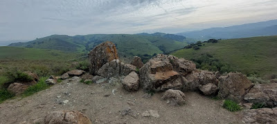
There are amazing views in almost all directions.

I walked around the area that I was told was okay for me to be.

There is a ton of stuff to learn about the Lick Observatory and the history of the people that have lived and worked up there. It really is amazing that such a special place can be so close to a burgeoning city like San Jose and remain isolated in its quiet vigil among the stars. 

I stayed up there for about thirty minutes, absorbing Mt. Hamilton's holy vibe, and plunged back down the road. Hondo, fortunately, was made for this kind of thing, and hugged the road effortlessly. I stopped at the Twin Gates trailhead to scout the route to Antler Point. Sorry, I lied about coming up here again. If I want to visit Antler Point, another Nifty Ninety, I have to park at Twin Gates and do a 10-mile round trip hike to the Point some day soon. A little vertigo has never stopped me before, at least not that I remember.

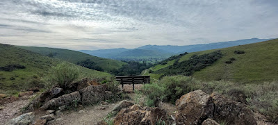
Then it was time to find the Dutch Flat Trail in Joseph D. Grant Park to knock off an out and back 6+ miler full of ups on the out and downs on the back. The reward for the ups was a scenic view point with a table and a bench for a hard-earned picnic lunch overlooking San Jose and a long look up at Mt. Hamilton. File this spot under hashtag pretty cool, hipsters. The downs reward was a trailside bog full of wild pigs and a few blue herons. I don't know about you, but I don't see that every day.


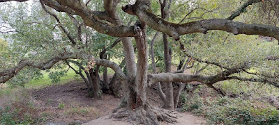
This trail gets bonus points for an end of the hike Boo Radley tree. If you don't know what a Boo Radley tree is, then shame on you for not paying attention. 


Peace, Love, and Harper Lee in the Stars,
Jim

Thursday, February 3, 2022

Sierra Azul Open Space Preserve - Woods Road

 Waxing Crescent Moon

Brrrr! Yesterday's segment of the Bay Area Ridge Trail, an out and back from the Woods Road trailhead in the Sierra Azul Open Space Preserve was cold and windy, but pleasant nonetheless. The wide, graded dirt and gravel road was a fast track, curving in and out and up and down in shady oak forest, with sunny views of Mt. Umunhum, the San Jose valley,  and Mt. Hamilton. I know that cold and windy is a description that may generate a smirk or two if you happen to be reading this in Siberia, but let's just say my California birthright of 70 degrees F and sunny was rudely violated. I could have used another layer, maybe even a puffy jacket, to be comfortable. It's okay, though, the biting wind acted like invisible spurs for Palomino. Giddiup!

I have been so impressed by how clean the Santa Clara County trails are. 


Sorta kinda azul up there on the ridge.

A Cold War radar structure on Mt. Umunhum.

Mt. Hamilton and the Look Observatory on the horizon beyond the wide San Jose valley.

The most interesting parts of this walk to me were the brief glimpses of Guadalupe Creek and the frequent opportunities to examine roadcut geology. I took a shivering look at a small anticlinal fold and an even smaller rock slide, clear evidence, in case you needed a reminder, that Earth is not a static old stone adrift in space.


El Sombroso (2,999 feet), one of the Nifty Nineties, is another three miles beyond Barlow Road, my turnaround point for this hike. I decided to save that one for another day and probably access it from the opposite direction, from the Lexington Reservoir. Either way, it's a 12 mile hike plus the summit and I need a little more conditioning to tackle that right now. Getting closer, though.

Peace, Love, and Shiver Me Timbers,

Jim

Monday, January 31, 2022

Santa Teresa County Park, Santa Clara County Revisited

New Moon

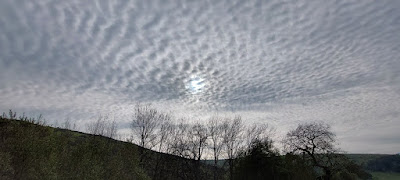
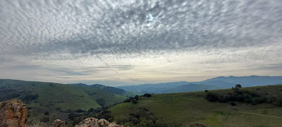
On a strangely cool, overcast Monday, I returned to the Santa Teresa Park near San Jose to finish up some Bay Area Ridge Trail miles. The sky was dappled with what I like to call brain clouds and the Sun was deep in thought way back behind them. On such a winter's day.

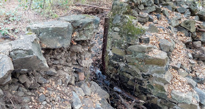
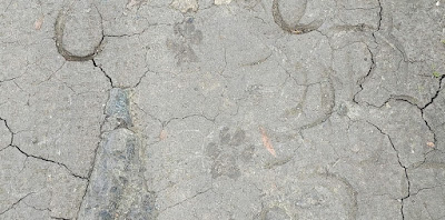
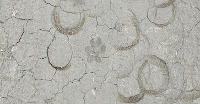
I took the Fortini Trail up along a little creek to its intersection with the BART. There was some sort of dam structure and a few cool trees, then I spied some mountain lion tracks, I believe, very clear on the dry, hard surface of the trail right next to the water. I think they were pretty fresh, made by a good-sized cat with wet feet. They were footprints more than tracks. The older, dried tracks made by horseshoes when the trail was muddy give you some idea of size by comparison. Pretty interesting, in my humble opinion.


After I climbed up to the main trail, the rocks and sky took over my attention. There were other hikers, but they were few and far between, all quite friendly and quiet. On one prominent hill, a short trail led to the top where a bench awaited anyone who bothered to notice. Great views there. I was sweating by then and didn't want to get chilled so I only stayed long enough to snap a few photos and say thanks.


Then came the switchbacks, which made a hilly adventure a little less taxing. Just beyond the park boundary fence was a long, elaborate rock wall. Somebody did a lot of work to build that thing. They reminded me of the rock walls I saw in Connecticut on my 2013 northern tier bicycle ride across the U.S. Different rock types, of course, thousands of miles and a continent apart.


After I finished my hike, there was one last odd piece of sky that called to me. It might be a dental x-ray cloud or something, I'm not sure. What I can say for certain is that this hike was fun and engaging and the weather added to its intrigue.

Peace, Love, and Wildcats,

Jim

Sunday, January 30, 2022

Mudstone Ranch, Hollister, California

 Waning Crescent Moon

Mudstone Ranch is part of the Hollister Hills State Vehicular Recreation Area, an 850-acre park south of Hollister on the San Andreas Fault. Mudstone is on the North American Plate, with 13 miles of trails for hiking, bicycling, and horseback riding. It provides a little bit of a sound barrier between the off-road vehicles and the suburban residential area to the north. The trails and old ranch roads are hilly so it's a good place to work your legs and lungs.


 Yesterday I hiked the Road Runner Trail to its crest, then switchbacked down the Glen Loop Trail to a deep creek drainage and up the other side past the transmission lines before turning around and repeating the course in reverse. Just as I began the hike back to the start, a man and his son cruised by me on their e-bikes. They seemed really nice and happy!

The crest of Road Runner is a good place for a snack.


The creek bed was a little muddy with lots of deer tracks, but no water.


After a rainy December, January has been completely dry and mostly sunny. It seems weird to see wild flowers starting to pop up this early, but I guess everything is out of kilter with the ongoing drought and uncertainty of seasonal changes. Plants and animals must go with the flow.


I got back to the parking lot just as the e-bikers were pulling up as fresh as a a couple of daisies. I made a cheery comment about it being a very good use of a Saturday afternoon and the Dad couldn't help but observe that I was limping. Old enough to be HIS Dad, I briefly considered spanking his backside and calling down fire and brimstone upon his $5,000 bike, but instead I just laughed and said, "No knee replacement for this guy!" (Besides, what the heck is brimstone anyway?). I felt happy and strong and only a little sore. I earned that limp.

Peace, Love, and One Step at a Time,
Jim

#2,022 in 2022
January mileage (after tomorrow): 174

Friday, January 28, 2022

Almaden Quicksilver Park Revisited

 Waning Crescent Moon

I went back to this park yesterday to hike the eastern half of the Bay Area Ridge Trail segment from Mockingbird Hill to English Camp. This piece began right at the edge of suburbia with groomed trail, lush green grass, and photogenic mammals. It quickly became quite steep with great views of sprawling, nearby San Jose. Although a little hazy, it was a good day for a healthy workout on the way back up to Mine Hill. 


Much of the upper portion was forested and shady. There were lots of interesting trees as well as outstanding outcrops of serpentinite and cinnabar. Once again, the bicyclists were courteous and there were only a few stray pieces of litter. It might sound funny to you that I even bother to remark about those things, but I'm giving credit where credit is due. Leave No Trace is more than a slogan. It's a lifestyle and a very positive one.


My favorite place on this hike was the San Cristobal Tunnel, which was my turn around spot. This (now closed) tunnel leads to the San Cristobal Mine on Mine Hill and it dates back to 1866. Old mines and tunnels are somewhat mysterious and 100% historically important, not to mention potentially dangerous. For fans of spooky superstitions, it might be fun for you to read a little about tommyknockers!). It's probably a good thing that these places are blocked off from the over-curious, careless, and clumsy among us, but it's also good that we get to peer inside in wonder. Just imagine the work that went into this tunnel's construction.


The hike back to Hondo featured lots of downhill grunting, but I was able to get on the road and beat most of the traffic to once again be safe at home. This month of increased activity away from my own backyard has been fun and rewarding. With only three days left to hike in January, I am on pace to reach my mileage goal for the year (157 miles so far), I have pieced together 60 of the 400 miles of the Bay Area Ridge Trail, and I have topped out on 13 of the Nifty Nineties. The BART and the Nifty Nineties will get tougher and tougher to complete because pretty soon I will have hiked all the stuff that is closest to me. Hello, Bay Area traffic jams.

My great friend and geoscience mentor Rob Negrini saw my previous post on the New Almaden area and messaged me about a Wallace Stegner book called Angle of Repose for which Stegner received a Pulitzer Prize in 1972. The book, divided into five parts, covers the history of four generations of an American family as told by a retired historian confined to a wheelchair. Part II is set in New Almaden and is centered around the experiences of a mining engineer named Oliver Ward. Stegner was a master novelist and Stanford professor, whose students included Ken Kesey, Larry McMurtry, and Edward Abbey. Angle of Repose is recommended reading for certain.


Peace, Love, and 2,022 in 2022,
Jim