Friday, January 14, 2022

Uvas Canyon County Park - Waterfall Loop

 Waxing Gibbous Moon

Yesterday I returned to Uvas Canyon Park to hike the Waterfall Loop, plus the Contour Trail and the Alec Canyon Trail. It was a most pleasant way to spend a few relaxed hours on a partly cloudy, mildly cool day. These trails are not as strenuous as the Knibbs Knob Trail, so I didn't get as gassed as I did on Monday. There were many things to see and admire, but little wildlife. The presence of a half dozen small groups of hikers and their chatter saw to that. I'm sure they didn't mean to be loud and obnoxious and scare away the deer, they just weren't very aware of their surroundings. City folk. Different stroke.

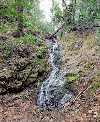
The waterfalls were small but fun - nothing like the Sierra Nevada and Cascade Range waterfalls I am used to - but hey, what can you expect. I enjoyed walking along the creeks and seeing/hearing them, realizing how special this place is so close to large population centers. 


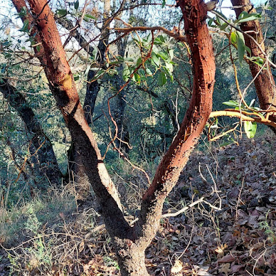
I especially like the way the flowing water sculpts and colors the rocks and the contrasting colors of the trees and moss. This park is really pretty and the trails are in tiptop shape. The Contour Trail provided some fun ups and downs and a few long views, reminding me of the views from Knibbs Knob. Along the way were some interesting mushrooms and tree shapes.


The Alec Trail led me to Triple Falls and the site of an old logging camp. The quality of my pictures doesn't do justice to the beauty of Alec Canyon's trees. This stretch is really special.


My 2,022 in 2022 goal is progressing without a hitch and it has pushed me to explore new (for me) places in the nearby woods. I  think next week I will try to climb Bald Mountain and maybe one or two others. I will definitely be hiking some more trails in the area south of San Jose. Fun!

Peace, Love, and Footsteps,
Jim

Tuesday, January 11, 2022

Uvas Canyon County Park - Knibb's Knob

Waxing Gibbous Moon

The word knob is derived from the Scandinavian word knobe, in case you were wondering, and in this usage, according to my Smartyphone, it means a round, prominent hill. Henry Knibb was a pioneer who homesteaded some land in the area in 1891. Knibb's Knob (2,694 feet) is a peak in today's Uvas Canyon County Park in the Coast Range west of Morgan Hill, CA. 

Before Henry and others moved in and, as was fashionable in those days, declared ownership of the land out of the clear blue sky, Knibb's Knob and everything else as far as the eye can see was Amah Mutsun territory and had been for thousands of years. Henry et alia commenced to cutting down trees and selling them to support the nearby New Almaden Quicksilver Mine, California's oldest (1845) mining operation. Quicksilver (mercury) was used as a reduction agent in gold production and the rest, including today's Silicon Valley, is manifest destiny. 

There is some goodness left in the world and thank goodness for things like county parks that preserve it. The Amah Mutsun have made an agreement with the county to limit daily human traffic to the area by use of a reservation system. Yesterday, with permit in hand, I ventured into Uvas Canyon to walk the Knibb's Knob Trail up to the peak (aka a prominent hill in the park). I wondered upon arrival what the Amah Mutsun call it (probably not Knibb's Knob, duh). Uvas Creek is flowing strong right now, so the little waterfalls that dot the park are in fine form. I didn't visit any of them on this trip. I will return soon to hike the Waterfalls Trail and enjoy them, too. 

The top of the wooded hill is only a little over two miles from the parking lot, but boy howdy, it's a steep two miles. I am loving my 71st year on this blessed planet immensely. However, my enjoyment yesterday was punctuated by regular grunting and the occasional wheeze. The 1.8 miles from the trailhead to the peak took me a little over an hour and a half, which is kind of ridiculous. I am officially and demonstrably old, but I managed to get over the hill without croaking. The trail is a wide, switch-backing fire road that snakes its way on a steady grade toward the summit. The views are great and the cool temperatures in the shade make the climb more bearable. 


The "peak" (rounded hill) is heavily wooded with a picnic table on top, where I feasted on my peanut butter and banana sammie and poked around a little to see what I could see. Despite taking so long to get there, I felt strong and happy to have made the trip. It's a special place to be sure. I am lucky to have seen it on such a beautiful day.


What goes up must come down, which is where hiking poles come in handy for the septuagenarian recreationist. I got back to Hondo in a gravity-aided hour, pleased with my Monday adventure and ready to come back to Uvas Canyon for more.

Peace, Love, and Stoked for Some Waterfalls,
Jim

Sunday, January 9, 2022

Henry Coe State Park - Hunting Hollow to Gibson Pond and Bill's Hill

 Waxing Gibbous Moon

The Hunting Hollow entrance to Henry Coe State Park is 25 miles north of my camp on the edge of San Juan Bautista. It's a popular launching spot into the backcountry for hikers, backpackers, mountain bikers, and horseback riders. At 87,000 acres, Henry Coe is the largest state park in northern California with over 250 miles of trails and dirt roads. Most of it is pretty challenging, as in steep canyons and ridges with few water sources. I like it, but I am getting to the point of avoiding the more difficult parts. I have nothing to prove to anyone but myself.

One less difficult hike is to follow the creek along Hunting Hollow Road to its intersection with the old Wagon Road and return to the start. To add some climbing, though, side trips to Gibson Pond (easy) and Bill's Hill (not so easy and one of the Nifty Ninety from my last post) make this hike borderline strenuous. The scenery along the creek is nice, but relatively monotonous - mostly old oaks draped with hanging moss and steepening hillsides covered with grass. Several trails lead up (up is the key word here) to the ridges towering over Hunting Hollow. There are three more peaks in this park that I will eventually have to tackle. To reach them, I will have to get my poor old bones in much better shape. 


The creek was running continuously after all of our recent rains. The dozen or so crossings were all very easy though, stepping on rocks and logs, avoiding the ankle deep ripples. I have loved following creeks my entire life. 


Cows roam free in this part of the park, so drinking from this stream (or any other water source) is a big no-no without a good filter. I was only gone a few hours, so a full 1.5-liter water bottle and a juicy tangerine from home on this cool day were all I needed. 

Gibson Pond was located in a nice, secluded area, but it was a dull, baby-poo brown color like most of the cattle ponds scattered around the park. I have filtered water from places like this many times on trails in southern California and Arizona and New Mexico, but it's not really my favorite thing to do.  

One reason I do not like cows.

The trail up Bill's Hill (1,988 ft) is unmarked, feint, and steep. I'm not sure this one was really worth the effort. I did manage to find a pretty nice mushroom, however. 


Mossy oaks, mossy oaks, mossy oaks. Mossy oaks were everywhere. Overall, this was a good conditioning hike on a pleasant winter Saturday, but less than sensational visually.


If I can get my trail legs back, I will return to climb Willson Peak in a month or so. I'll probably make an overnighter out of that one so I can freeze my heiny off and watch the sunrise under the blue oaks at the top.

Peace, Love, and 2,022 in 2022,
Jim

Wednesday, January 5, 2022

Coyote Peak Loop Hike

 Waxing Crescent Moon

I have been tossing around ideas for 2022 hikes for some time now. Prospects for large scale hikes remain dim with the ever-lurking specter of viral variants and travel risk so at least for now, I am staying local and doing my best. Wherever it ends up happening, my minimum goal is to walk 2,022 miles this year, a reasonable average of 5.54 miles per day. Barring injury or illness or psychiatric collapse, I should be able to manage that.

I recently discovered a Sierra Club pdf entitled the "Nifty Ninety" that lists ninety non-technical Coast Range peaks to "climb" (hike, really) in the Bay Area. Most of them are below 2,000 feet above sea level. Mt. St. Helena at 4,339 feet, is the highest one. So I decided to give that project a go between now and summer just for a change of scenery. 

Yesterday I drove to the Pueblo Day Use Area in Santa Teresa County Park near San Jose to do a loop hike that included the short climb up to Coyote Peak (1,155 feet). The rainstorms from the past few weeks left the trails pretty muddy, but they also greened up the hillsides and filled in the creeks with cheery running water. Lots of ups and downs gave me a decent workout and blew stale, vax-murdered, COVID corpses out of my lungs. It was fun! The first mile was a steady, semi-steep hike to the turnoff for Coyote Peak on a wide, wet, curvy dirt road.

Hidden Spring Trail from the Pueblo Day Use Area

There were lots of outcrops of serpentinite, California's state rock, along the way, including one big one which made me wonder how and when it became so fractured.


The left turn on the Coyote Peak Trail came sooner than expected and a minute after that I was on my way on the side trail to the top. An easy-peasy stroll past some power lines and there I was, overlooking San Jose with views of the Diablo Range on one side and the Santa Cruz Mountains on the other. Spectacular banks of clouds provided most of the visual entertainment. In just the ten or so minutes I spent up there, the sky changed dramatically, sometimes opening up to show glimpses of snow atop the highest peaks to the east.


My favorite stretch of this hike was the Rocky Ridge Trail, which wound along the side of a ridge littered with small (basketball to beachball sized) serpentinite and greywacke boulders of the Franciscan Formation. The Sun broke in and out of the clouds the whole way and blue sky started to edge out the clouds. The mud on the trail was sticky and sloppy in parts, but there were lots of rocks to step on in the worst puddles. At the start of the trail, which is popular with mountain bicyclists, someone had written BRUISE on the pack of a trail sign. That would be the minimum result of a crash in the rocks here. 


The Rocky Ridge Trail switchbacks down into a canyon, crosses a wooden bridge, and meets up with the Mine Trail that takes you back to the Pueblo parking lot, completing the 3.5 mile loop, or leads you in the opposite direction toward Calero Creek. I explored the Mine Trail and the Fortini Trail for a mile or so before turning around and heading for Hondo. 

So far, I have walked to the top of Mt. Tamalpais, Mt. Umunhum, Mt. Madonna, and Coyote Peak. I think I will try Nibbs Knob next time.

Peace, Love, and a Most Pleasant Walk,
Jim

Sunday, December 19, 2021

That's All He Wrote

 Full Moon

I quit. 

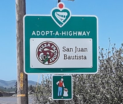
Yesterday was my last day as a Caltrans Adopt-a-Highway volunteer. After eleven years of picking up trash on Highway 156 each month, I am hanging up my grabber, turning in my hardhat, retiring my dayglow orange-yellow safety vest. Someone else will have to clean up after the pig people.

I am not "The Logo" for Caltrans, but it kind of looks like me.

I am not quitting because of any particular reason other than I am tired of doing it and my bad knee balks at skidding down the steepish roadside slopes into the drainage ditches to retrieve thousands of exploded pieces of Styrofoam or the occasional wayward tangled up deflated Mylar balloon or a heaved poop-filled diaper. What kind of Mom heaves a poop-filled diaper out the car window? If you need to assign blame on my exit from the ranks of highway angels, finger idiots like her. I have done my service to the San Juan Bautista community many times over. Now is the time for the next generation to step up.

I like it clean.

These years were not without fun. Every once in a while, friends like Captain Chem or Commander Cody or Chiquita Anita would pitch in to help. Sometimes there were monetary rewards. Once I found half of a a 20-dollar bill sticking up out of the dirt. I dusted it off and checked to see if the serial number was intact. It was complete so I mailed it to the Department of Treasury in Washington, D.C. with a note saying where and how I found it. Sure enough, about three months later, a brand spankin' new, crispy Andrew Jackson arrived in my mailbox. Andrew Jackson was an a$$hole, but he paid for breakfast that day. 

Then there was this story, the day I had to pick up all kinds of panty liners on Highway 101.

But this one just might be the best roadside toy tale in history.

I told, via  Facebook post, the local citizenry of my decision to retire and asked nicely if there might be a person or group of persons who might like to replace me. The responses were lukewarm in terms of volunteers, but there were many grateful and sincere words of thanks and praise for my years-long efforts. I appreciated that and to them and to all of America, I say, "You are welcome."

Peace, Love, and Trashy Memories,

Jim       

Wednesday, December 8, 2021

Beach Walk

 Waxing Crescent Moon

A rare overnight rainfall Monday night gave way to a cool, crisp, sunny Tuesday morning in Moss Landing, CA, which is, as the crow flies, or as Hondo scoots, the closest beach to my camp. I met Captain Chem for a post-birthday breakfast and beach walk. Captain Chem, ever the alert and literate blog reader, almost immediately asked me how old I was. To which I replied:

"I am in my 71st year, thank you very much."

The grin on his face revealed his sly attempt to catch me in a septuagenerian error, but I was onto him. I am finished with being 70 period.

The Moss Landing Cafe was first choice for vittles, but they are closed on Tuesdays, so we took a chance on the satellite-eatery, over-the-bridge version of Phil's Fish Market. It's kind of rudimentary, but it will do in a hungry pinch and the people there are super-nice. It has both indoor and outdoor seating. 


Parked in front of of the market/eatery/convenience store was a funky cruiser bicycle which, as I later discovered, belongs to a local character known as Pirate Don. Sadly, Pirate Don was nowhere to be found on Tuesday, but if you see him, tell him I like his ride. Except for the saddle. I do not think that saddle would be comfortable.


The greatest things (aside from the Pacifc Ocean and the sand dunes) about Moss Landing State Beach are twofold: 1) you can walk for a long way between the jetty and the Pajaro River and back and 2) it is rarely crowded during the week in the waning days of autumn. 


The scenery and relative isolation are conducive to purposeful striding and stream-of-consciousness world-problem-solving. Some Palomino-Captain Chem conversations are quite brilliant if I do say so myself, and alternatingly funny as hell. Maybe we should start taping these hiking wisdom nuggets for broadcast or podcast or outcast podcast or something. When the good Captain completes his 70th year in 2023 I think it is, if there is still such a thing as the Internet, we can begin to share with the world the many ways they can get their sh*t together. The Septuagenarians might stream all the way to Netflix.

One way that people could improve things is to knock off the whole oops-I-killed-a-porpoise-when-fishing-for-ling-cod nonsense. I think they call these accidents "bycatch."  Here is a definition of bycatch from Merriam-Webster:

"the portion of a commercial fishing catch that consists of marine animals caught unintentionally"

Okay, okay, it happens, they didn't mean to do it (key word mean), but my questions are: how and why did this poor critter get sawed so perfectly in half? Just to freak out septuagenarian beachcombers? The vultures and gulls will gladly, or at least efficiently, take care of it, I suppose.


Speaking of birds, there were planty of snowy plovers, curlews, gulls, pelicans, and yes, a few wary, but persistent vultures at the beach. They make a very good living from Monterey Bay and I don't believe they ever kill anything unintentionally. 


Peace, Love, and Be More Careful,

Jim

Saturday, December 4, 2021

The Sixties Are Over

 Waxing Crescent Moon

Well, the sixties are finally over. On Sunday, December 5, at 7:51 a.m. Pacific Standard Time, I will complete my 70th year as an ethereal spirit masquerading as James Raymond Ostdick in this rapidly aging bag of bones. From then until next December, I am supposed to say I am 70 years old, even though as every second goes by I will actually be living out my 71st year. 

Whenever I have this conversation with people, no one seems very bothered by our custom of understating our ages when asked. Saying I am 70 is not very precise. While it is true that I have lived 70 years, it is also true that I have lived 66 years, or 68. I may as well pick any other round number reasonably close to the way I look (as long as it is not over 70) if I want to abide by societal norms. 

However, I feel rather adamant that, to be forthright, I should admit that the sixties are over and done with. On this final day of my 70th year, I vow that I'm not going to say, if asked, that I am 69. The sixties have been over for quite some time now. Tomorrow, if asked after 7:51 a.m. PST,  "How old are you, Jim?" I am going to say, "I am in my 71st year, thank you very much."

This is me, finishing up my 70th year on Earth. I feel fine.

 
This morning my camp and its surroundings were smothered in a thick marine layer.

It was chilly when I got up so I hustled over to the Mission Cafe to treat myself to a pre-birthday omelet. I wanted to take one more 70th-year hike at Fremont Peak State Park, so I was going to need some righteous sustenance. Just like I knew it would be, the omelet was both righteous and delicious. 

Imagine my surprise when I was ready to leave, all fired up by eggs and coffee, and my pretend Mission Cafe granddaughters/waitresses Maria and Jessica announced that my meal was on them. They were all smiles and happy birthday tomorrow wishes as I fished out some bills to leave them a tip anyway. Very cool way to start the day. I made a mental note that if I should happen to win Superlotto this evening, I will definitely buy each one of them a brand new car. Pretend Grandpa is righteous, too.

On the way up San Juan Canyon to the park, I stopped at an overlook to check out the view down into San Juan Valley. This is one of my favorite things to do when things are socked in down below. 

This makes me imagine the ocean just broke over through the
Coast Ranges and created a whole new landscape.

Up in the park it was sunny and warm and I had the place to myself. There are about six miles of hiking trails. I chose to do the loop starting from the upper parking lot: the Valley View Trail to the Cold Springs Trail to Tony's Trail to Carmen's Trail back to the beginning. Took me about two hours, which is slower than I could do it even a few years ago, but who really cares? It was fun! The trails took me through madrone and oak forests with lots of moss and lichen. It was odd not to see any mushrooms or deer, although I did see plenty of deer tracks and scat. The trails, by the way, are in great shape right now.


On Carmen's Trail there was a lot of furry moss on the trees and rocks and many windblown pieces of what I am calling lichen. There is a good chance that's not correct. It's some kind of parasite anyway.


.

I also saw a Boo Radley tree, which always makes me smile.

I feel really good after today's hike, my last walk of what people call my sixties. As long as I can keep doing this kind of thing, I'll be a happy camper.

Peace, Love, and Oh Boy, I'm on My Way to Get a Giant Smoothie at Bliss Blendz,
Jim