Thursday, March 31, 2022

Toro Park, Monterey County, California

 New Moon

Toro Park, next to Highway 68 between Monterey and Salinas, is a well-used county park with a Youth Overnight Area and an Environmental Center used by local schools and over 20 miles of hiking, horseback riding, and mountain biking trails. Bikes are not permitted on some of the hiking and equestrian trails, so if you go, read the signs and keep the peace.

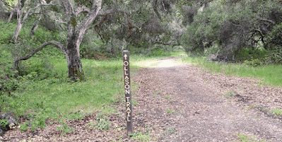
Yesterday I parked at the Quail Meadow parking area and hiked up the Ollason Trail for a while before returning to my car via the Gilson Gap Trail. The only map available was an online version that is pretty basic, but I ballparked the distance at around 6 or 7 miles. It was a chilly, overcast day with a persistent wind, but I was comfortable in a fleece jacket and windbreaker. 


.

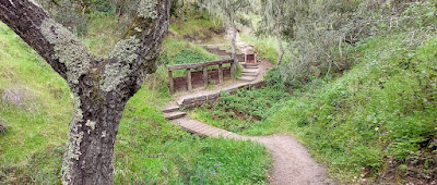
The trees in the lower part of the trail were laced with lots of beautiful hanging moss

As the trail gains elevation, evidence of an old cattle ranching operation appeared here and there - an old, rusty, noisy windmill and this nearly dry watering trough from 1913. Scattered around this area were a few wooden guzzlers constructed where birds and small animals can get a drink.


Continuing up toward Ollason Peak I saw lots of wildflowers, predominantly these purple and white  ones that I think people call silver lupine (?) or something like that. I don't spend much time worrying about what to call them - I just like seeing them. If you are one of my many friends who like to name flowers, you probably already know what to call these. Some of you can name them in more than one language and that's okay, too.


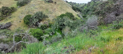
The hike became more interesting when I began the return run down Gilson Gap. From one point up there I had a long view toward overcast Monterey Bay. As I was admiring that scene, a pretty good-sized bobcat padded across the trail about 50 yards ahead of me. It was not in a big hurry it seemed, but it was gone in a few seconds - too fast for a photo - and it vanished into a brushy ravine lickety split. Just past that point were some conspicuous granite outcrops that were by themselves on a ridge - like random, shapeless monuments. 


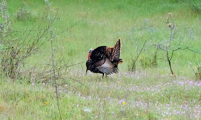
Soon I was treated to a turkey sighting. Several turkeys, actually, but I was only able to get a couple of good shots. A rebellious bicyclist zoomed past me while I was taking a picture and blew up the whole scene as the turkeys slinked off into the cover of some bushes. Rude dude. Not a bike trail, rude dude. Not even a vocal warning "On Your Right" or a grunt or a hello, either. Rude dude. Anyway, the turkeys were cool.


As I neared the end of the hike, the air temperature warmed a bit and the wind died down enough to find a spot to stop and eat my sandwich. I was thankful for the animal sightings and the chance to visit this beautiful park I have passed by hundreds of times, always in a rush to get somewhere else - to the beach or to the mountains. Toro Park is a great in-between stop to hike and check out the scenery. I'm sure I will be back. The Cougar Ridge Trail is next.


Peace, Love, and Locals,
Jim

#2,022 in 2022 Update: 509 miles to date

Friday, March 25, 2022

Henry Cowell Redwoods State Park, Felton, California

 Waning Crescent Moon

Henry Cowell Redwoods State Park (not to be confused with Henry Coe State Park) is nestled along iconic Highway 9 near Felton, CA, seven miles inland from Santa Cruz. As its name suggests, the park's main feature is its gorgeous redwood forests, but there is also a campground, visitor center, nature store, and miles of hiking and riding trails next to and above the San Lorenzo River. 

Just about everything along Highway 9 retains a little bit of flavor from the long-gone hippie era - it's kind of nostalgic now for anyone who spent time in the area 50 or more years ago. You can still find holdouts, wannabes, and grandchildren of hippies minding stores in Felton, Ben Lomond, and Boulder Creek if you hunt for them. Just look for establishments with the word Mystic on the street sign. In general, they sell plants, jewelry, and sandwiches. 

Yesterday I cruised up Highway 1 through Santa Cruz, boomeranged around the crazy fishhook exit to River Street and snaked along 9 to the park for a loop hike through the forest. Conditions were warm and sunny with lots of folks buzzing around gaining energy from the big trees. The visitor center was closed but the nature store sold trail maps, one of which helped me figure out where I wanted to go. I eyeballed a route that would let me walk next to the river for a while, circle around to the centrally located observation deck, and wind my way back down to the river. Even though the map didn't include mileages for any of the trails, I judged the route to be about 7.5 miles by adding up the numbers on the trail signs and comparing that total to my map scale estimate. Worked out great! I had not visited this park since about 1975, so it was exciting to compare this trip with my fuzzy old memories. Walking through the trees will never get old.


There are many ways to do a loop hike through the park. I started at the visitor center and followed these paths: the River Trail past Cable Car Beach to the Eagle Creek Trail connector, up Pipeline Road for a snack at the Overlook Bench, continue on Pipeline Road, left on Powder Mill Fire Road, left on the Pine Trail to the very cool Observation Deck, continue down the Pine Trail to a left on the Eagle Creek Trail which loops around back down to a right on the River Trail to the visitor center. 

I met a couple of friendly women on horseback, a few young couples, two families with kids from some European country I could not identify, and a gaggle of energetic college women who were happy to get a look at my map to decipher the way back from the Observation Deck. In between slices of my tangerine, I pointed out the route and suggested a pneumonic to help them remember. Unfazed by my absurd pneumonic, they bounded down the Pine Trail, happy to not be unfound in the wilderness, haha. I was equally happy to have performed a directional service other than making sure I myself had another pleasant day wandering around on planet Earth. 

The ocean view was obscured by a marine layer when I was up there,
but this northwest view from the Observation Deck was fine.  

The flow was predictably low, but I really liked winding my way along the River Trail in both directions. I have enjoyed hiking beside rivers and streams in so many locations for as long as I can remember. I hope I can keep doing that for eternity.


Near the visitor center there is a short loop through a beautiful stand of giant redwoods. Some of them are so big I couldn't figure out where to stand to photograph them. As usual, I just pointed my Smartyphone and clicked. Take my word for it, these puppies are huge.


Insider info: Johnnie's Super Market in Boulder Creek has a deli in the back where hilarious grandchildren of old-time Santa Cruz hippies make the best sandwiches from here to Mazama, Washington. I got a funny tip about a Netflix series called Is It Cake? which I will investigate soon in between March Madness festivities. You can't go wrong with sandwiches or Netflix tips  from the grandchildren of hippies. Count on it. Take that advice to a Mystic Savings and Loan in a mountain town near you. Many happy returns.

Peace, Love, and Redwoods,
Jim

#2,022 in 2022

Wednesday, March 23, 2022

"Emergence"

 Waning Gibbous Moon

Just in time for the Spring Equinox this past Sunday, a group of local Native artists and engaged citizens combined to create a street mandala they call Emergence on Mariposa Street in the center of the San Juan Bautista historical district. It was painted with non-toxic tempura paints that will wash off/erode in a month or two. Like any work of art, it is open to different interpretations depending on the beholder. You might see it as a symbol of changing seasons or of mother nature's patterns or of a shift in a socio-political paradigm, or of an emergence from the past few years of being cocooned by social distancing. These photos are not very professional and they do not show the best (overhead) angles of the mandala, but I hope they give you an idea of its beauty.


I feel a combination of things when I stand there and soak in the messages of the mandala. Most moving for me are the cyclical nature components. They reinforce the sense I have that it is time to get back to my roots, to emerge from being so carefully restricted, to put on my pack and hike real miles with my "home" hanging off my shoulders, changing places nightly. I want to go backpacking and I want to go soon, while I still have the strength and the health to move along with the rhythms of the land.

Of course, for me, carrying a pack in the mountains requires training beforehand lest old bones and connecting tissues rebel and sideline me for untold days and weeks. After much consideration and map study, yesterday I took my first steps in that direction by driving. I followed the twisting, narrow road up to nearby Henry Coe State Park with a full pack in the back of my trusty Hondo. This was to be my first overnight hike with gear in almost three years. 

However, when I arrived at Park Headquarters and consulted with the friendly and efficient Ranger, I learned that many local colleges are on Spring break right now. Most of the backcountry campsites within my current realistic hiking range were already taken. The dispersed camping sites (undeveloped areas you can camp without a permit) are located beyond the miles I wanted to or could do at this point. So I decided to do a three-hour loop hike wearing my pack over lots of steep hills just for practice. I accepted the facts that my emergence will be a slow grind and that this day was just its beginning. Henry Coe's trails (mostly hilly) and dirt roads (ridiculously steep) are terrific training grounds for long hikes. It was a great day for hauling a load up and down in this most perfect season. 

My chief observation from yesterday's walk? That place is a woodpecker paradise.

I have no idea how this tree came to be, but I like it.
No, I don't think woodpeckers sculpted this tree!

The Monument Trail

View from very steep Hobbs Road

Another view from Hobbs Road

I am happy to say that I awoke this morning none the worse for wear, but very cognizant of the need for further loaded shakedown cruises and simple overnights before the summer comes and I can head for the high country. 

Peace, Love, and Re-Emergence,

Jim

#2,022 in 2022

Monday, March 14, 2022

Point Lobos State Natural Reserve, Carmel, California

 Waxing Crescent Moon

I don't typically use the word fabulous, but today, my friends, was fabulous. That's because I drove to the fabulous Point Lobos State Natural Reserve, about 45 fabulous minutes from home, with the hope of seeing a fabulous grey whale or three while doing a fabulous loop hike around the park. Sunny (fabulous). Upper 60's (fabulous). Pretty crowded for a Monday (I ignored that). The folks were well-behaved, though, and I had a fabulous time looking at the fabulous ocean and the fabulous trees and the fabulous rocks. I have already exceeded my fabulous quota for 2022 and it's only March 14 (Pi Day, which is also fabulous). Here is a fabulous photo to start things off.

I decided to grab the first available parking spot, which turned out to be facing the scene in that picture, right by the South Shore Trail. That's where I started my walk. I never spied a whale in my two and a half hour walk, but I also did not care. It was way too beautiful to entertain any thoughts of disappointment. Just for serendipity's sake, I took a photo of a sorta-kinda Pi in the sky, haha.

Use your imagination.

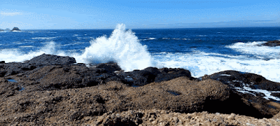
The South Shore Trail led me around to Hidden Beach, a small cove in a slot in the rocks with regular, crashing waves and a bed of coarse, well sorted sand pebbles and tiny shells. I tried and failed to catch a big breaker on my Smartyphone, but what the heck, I'm old and slow and this is the best I could do. I did get one pretty big sploosh around the corner, though.


After Hidden Beach, I walked the Bird Island Trail to look at the cormorants and their friends sunning on the poop-encrusted rocks before I took off on the South Plateau Trail, heading through the woods toward the park entrance.


From the entrance, I took the Carmelo Meadow Trail to Granite Point, then doubled back on that trail around Whaler's Cove to the parking area for the North Shore Trail. Somewhere in there I saw a healthy bed of Miner's Lettuce.


The North Shore Trail, maybe the best hiking trail in the park, was pretty crowded, so I didn't stop very often. I looked for harbor seals and any other big critters, but I didn't see any, unless you count humans. I kept moving, focusing on foot placement and balance on the roots and rocks and granite steps. This was a very enjoyable segment of my hike - you could say it was fabulous - all the way to Sea Lion Point.


The trails that used to let you walk all the way out to Sea Lion Point have been closed for some time, possibly permanently. I used to take groups of high school kids out there on field trips and wonder IS THIS SAFE? It was intoxicating to be out on the edge of the continent with the wind blowing and the sea lions barking and the waves crashing and the distinct possibility that I might be stripped of my teaching credential or worse if a rogue wave from  the fabulous Monterey Bay Marine Sanctuary decided to snatch one or more of my kids and bash them against the unforgiving Carmelo Formation turbidites. Those rocks are VERY hard and VERY rough on teenage skin and septuagenarian skin, too. It's probably just as well I can't go out there any more. I am not ready to disappear quite just yet.


Pretty soon I was back on the South Shore Trail, my Lobos Loop complete. It was a very good place to sit and eat my lunch.


Peace and Love from Fabulous California,
Jim

#2,022 in 2022